
Woodridge Neighbor Record Sources
Each official source answers a different block question. The map defines nearby parcels. The assessor identifies owner, billing, situs, tax, and sale fields. The recorder supplies deeds, plats, and association declarations. Voter address search returns precinct and representatives for one address, not a public roster. Local associations publish governance and contact channels while keeping member lists private.
| Source | What it shows about a block | Access |
|---|---|---|
| Woodridge Community Map | Parcel outlines, addresses, layers, zoning and flood context | Public interactive map |
| DuPage parcel layer | PIN, owner/billing, situs, class, acreage, legal fields | Public GIS or REST layer |
| DuPage assessor | Owner, billing address, tax year, exemptions and sales | Public parcel search |
| DuPage Recorder | Deed, mortgage, plat and declaration parties | Online index; office fallback |
| DuPage election search | Precinct and representatives for one address | Public address confirmation |
| Village permits | Building or remodeling event at an address | Monthly PDFs; FOIA for file |
| HOA or condo source | Common areas, bylaws, meetings and management contacts | Public documents; roster private |
An owner name can be useful without proving occupancy. A tax mailing address may point elsewhere. A deed may name a trust or lender. For accurate Woodridge neighbors research, label people as recorded owner, billing party, deed party, permit applicant, or association contact according to the source.
Map Woodridge Neighbors by Parcel
The GIS adjacent-parcel method is the most defensible way to define the area around one Woodridge address. The DuPage help material provides search tabs, Shapes, Buffer, Results, Zoom To, and Search Surrounding Area. A buffer selects parcels within a distance, while a legal block may end at a road, creek, subdivision line, or cul-de-sac.
- Open the Woodridge Community Map or DuPage parcel viewer and locate the subject address or PIN.
- Use Zoom To, map browse, Search Surrounding Area, or a modest buffer. Save the adjacent PINs and situs addresses before collecting names.
- Run each PIN in the assessor record. Compare the physical property address with the billing address and note any multi-PIN or condo unit structure.
- Check the Recorder when a plat, common area, trust, or association declaration matters. Switch counties for any Will or Cook edge parcel.
- For a full road rather than the immediate block, use the Woodridge street directory process.
Keep a worksheet with the subject PIN, adjacent PINs, map date, situs and billing addresses, recorder document number, and source for every field. That record makes later corrections possible when a parcel changes hands.
Woodridge Billing Is Not Situs
DuPage GIS separates BILL fields from PROP fields. Billing fields describe tax correspondence. Property fields describe the parcel's physical location. A match between them may support possible owner occupancy, but it does not identify every neighbor in the home. Exemptions are also evidence about a claim on the parcel, not a household roster.
| Field | What it means | What it cannot prove |
|---|---|---|
| PROP address | Physical parcel address | Every occupant |
| BILL name/address | Tax correspondence party and destination | Residence at the parcel |
| Owner | Recorded property owner field | All family or unit members |
| Homestead exemption | Possible owner-occupancy claim | A current private roster |
This comparison matters for condos, trusts, and common areas. One mailing address may represent several legal units, while an association parcel may have no household at all.
Woodridge Associations Define Community
Neighborhood life in Woodridge is documented more clearly through association records than through any public resident list. Public sites can identify governance, common property, meetings, declarations, and a contact route. They do not make private member directories public.
Village IV
Village IV Organization describes 428 Manor Homes, 51 patio homes, and 123 townhomes with separate sub-associations, a clubhouse, pool, declarations, and public contacts.
Villages of Woodridge
Villages of Woodridge Association publishes bylaws, meeting information, minutes, and notices for its condo community.
Woodridge Association
Woodridge Association provides self-published community information. Verify current activity before relying on an old meeting page.
The Village HOA guide describes maintenance, dues, restrictions, amendments, and recorded declarations. Use the DuPage Recorder to find the actual plat or declaration that controls a specific parcel. An association contact can answer a community question, but it does not authorize release of its roster.
The captured Village IV public site shows this open-governance and private-membership distinction.
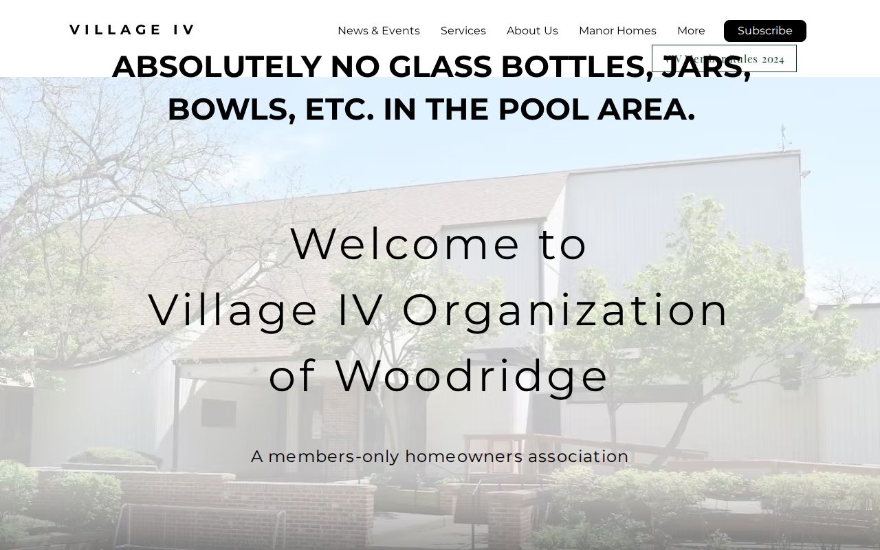
Its public history and sub-association structure help identify the community without exposing private resident contacts.
Woodridge Blocks Are Not Voter Lists
The DuPage election address search takes a house number, base street name, direction, suffix, and city. It can return precinct and representatives for that address. It does not publish a complete list of voters on the block. The state confirmation tool needs a name, birth date, ZIP, street number, and street name.
Illinois law redacts or restricts sensitive fields and limits use of released voter data. A non-match can reflect a spelling issue, old address, changed status, different county, or protected record. Do not infer that someone never lived in Woodridge. Use election tools for a defined civic confirmation, then stop at the result the custodian provides.
Note: A precinct describes political geography; it is not a directory of your neighbors.
Permits Show Woodridge Block Change
Monthly Woodridge permit documents can show when a roof, garage, deck, addition, pool, basement, or new structure changed the block. A permit applicant or contractor is a project role, not proof of residence. Code enforcement files can add address and issue context, though details may be limited.
If the posted PDF lacks the needed field, submit a narrow Illinois FOIA request for one address, record type, and date range. Village board or plan commission packets may also explain subdivision access, common areas, roads, drainage, or a development change. The Woodridge Community Portal is the best online fallback for those municipal documents.
Local newspapers and library photos can show how the same street looked in an earlier era. Treat those as dated historical evidence, not current neighbor data.
Choose Official Woodridge Neighbor Records
Commercial neighbor tools often merge parcel records, old directories, and marketing data. The blend can be stale, omit sources, confuse people with the same name, and treat a billing address as a home. Official records have narrower roles, but they identify the custodian, record date, and field meaning.
| Question | Official route | Commercial category risk |
|---|---|---|
| Which parcels touch? | Dated GIS map and PINs | Unclear map age |
| Who owns a parcel? | Assessor and recorded deed | Stale ownership |
| Which HOA governs? | Plat, declaration, association site | Missing legal source |
| Who occupies a home? | No complete official public roster | Unsupported household inference |
For getting to know the block, a public association contact or a direct introduction is more reliable than inferred private contact data.
Protect Woodridge Neighbor Privacy
Parcel and tax systems do not reveal renters, household members, utility customers, delivery records, or private association contacts. Illinois Address Confidentiality Program participants may use a substitute address. Judicial privacy and election-redaction programs can also suppress protected details. These absences are safeguards, not search defects.
Lawful use. Use Woodridge neighbor records for civic curiosity, reconnecting, or personal safety awareness. Never watch, harass, intimidate, or harm another person.
Correct a wrong parcel fact with the assessor or GIS custodian, a deed problem with the recorder, and a voter issue with the election office. Keep source dates and avoid reposting sensitive fields. When the official record stops, do not replace it with a guess about who lives inside.
County routing is part of privacy and accuracy. Most Woodridge parcels are in DuPage, but village ordinances identify smaller Will and Cook portions. If the parcel map points outside DuPage, use the assessor, recorder, clerk, and court routes for the parcel's actual county. A postal Woodridge label cannot move a record into DuPage. Save the county layer and PIN with the worksheet.
Local history adds context without turning the block into a dossier. Woodridge Public Library holds photos, oral histories, early newspapers, and the Progress run. Search the street or subdivision for a road project, civic notice, association event, or development report. The DuPage Historical Museum can supply maps, real-estate records, and vertical files. Historical occupants should remain tied to the publication date and wording.
Physical geography can explain which parcels function as neighbors. The East Branch of the DuPage River, creeks, major roads, common areas, and cul-de-sacs may divide parcels that a circular buffer places close together. Compare the buffer with parcel lines, street access, plat boundaries, and association declarations. A legal block and a social neighborhood are different ideas, so state which one the source supports.
For condos, capture the unit PIN rather than stopping at the shared street address. Review the declaration for common elements and the association site for public notices. One building address may contain many separate owners, billing destinations, and legal units. Publishing a single inferred household list would erase those distinctions and may expose private contacts.
When online maps fail, contact the county GIS or assessor desk with the exact address and PIN. Recorder staff can help identify an older plat or declaration, while Woodridge Community Development can route an existing permit, code, annexation, or address-point record. These counter, phone, and FOIA channels matter because a broken viewer should not send a researcher to an unverified compilation.